by
Kwabena Asante and David R. Maidment
Center for Research in Water
Resources
Department Of Civil Engineering
The University of Texas at Austin
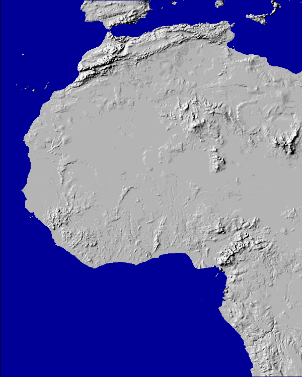
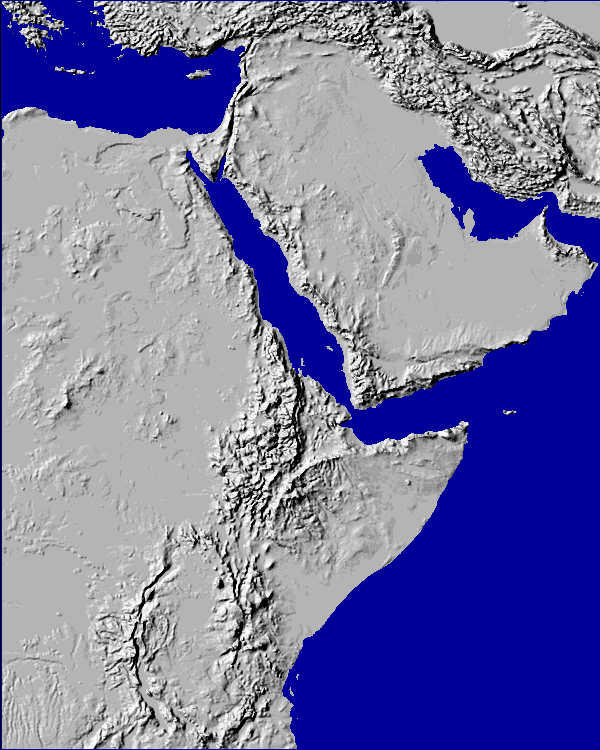
The Blue Nile basin in North Africa was delineated from 30" Digital Elevation Models (DEMs). A listing of the commands used in the delineation process are outlined below. The two GTOPO30 tiles covering North, West and East Africa, and the Middle East are
Tiles w020n40 and e020n40 for the western and eastern portions, respectively.
These tiles can be obtained from the USGS website at
http://edcwww.cr.usgs.gov/landdaac/gtopo30/gtopo30.htm
The tiles can be downloaded using a Web Browse such as Netscape. They are stored in compressed tar files namely w020n40.tar.gz and e020n40.tar.gz. These tar files contain the DEMs converted to images files.
To extract the DEM images from the tar files type the following at the UNIX command prompt:
$: gunzip < w020n40.tar.gz | tar xvf -
$: gunzip < e020n40.tar.gz | tar xvf -
All the resulting files need to be renamed with lower case names. This can be done by typing
$: mv E020N40.DEM e020n40.dem
(Rename all the tile files using a similar
command).
The image file e020n40.dem must also be renamed to e020n40.bil to enable it to recognized as an image by Arc Info. Type
$: mv E020N40.DEM e020n40.bil
The delineation of the watersheds was done in Arc Info but the image files presented here were captured in ArcView to enhance the presentation.
Open Arc Info with
$: arc
At the arc prompt startup the grid module with
Arc: grid
Convert the image file e020n40.bil to a grid with
Grid: gridimage e020n40.bil afre_dem
Grid: afredem = con ( afre_dem <> 55537 , afre_dem )
(Note: This command removes cells representing
the ocean surface from the DEM. Ocean cells are assigned a value of 55537 in the 30"
DEMs produced by the USGS).
Grid: mape afredem
Grid: gridpaint afredem value linear nowrap gray
The setwindow command resets the analysis extent in grid. Subsequent operations are only performed on the portion of the grid within the window defined using the command.
Grid: setwindow *
Drag the cursor across the view to define the study area
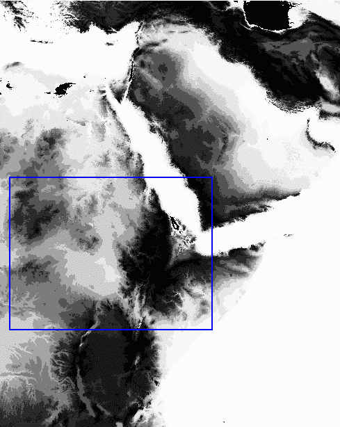
This results in a cross hair cursor that can be used to define the region of analysis. The coordinates of the area selected for the Blue Nile analysis is as follows:
longitudes 21oE to 45oE
latitude 1oN to 19oN
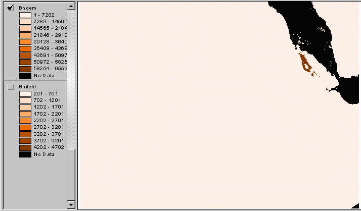
Grid: bndem = afredem
The resulting DEM contains 6,103,965 cells.
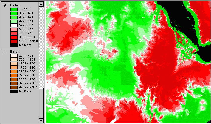
Notice what happens to the same DEM when the legend is changed from a linear scale to quantile scale (in ArcView3).
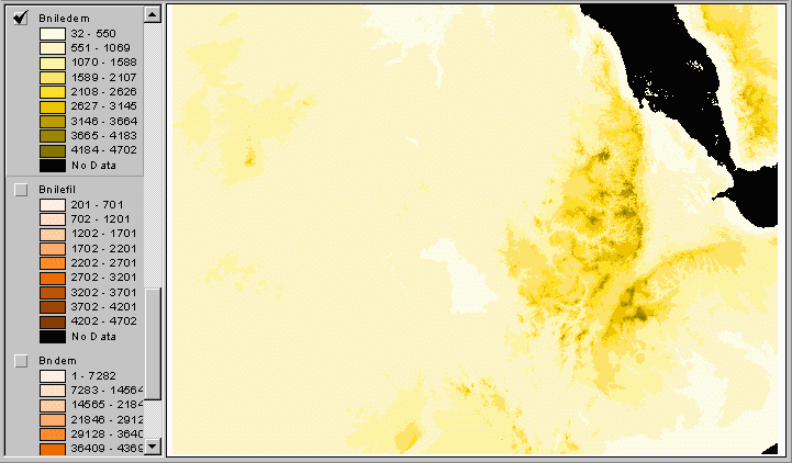
Grid: bniledem = con ( bndem < 55537 ,
bndem + 200 , bndem - 65335 )
(This command creates a grid in which the
elevation of the land surface is raised by 200. This ensures that the gird does not
contain any negative elevation values. The flow direction and flow accumulation grids are
unaffected by this change but elevations cannot be read off this grid directly).
Grid: describe bniledem
Description of Grid BNILEDEM
Cell Size = 0.008 Data Type: Integer
Number of Rows = 2135 Number of Values = 4418
Number of Columns = 2859 Attribute Data (bytes) = 8
BOUNDARY STATISTICS
Xmin = 21.335 Minimum Value = 32.000
Xmax = 45.160 Maximum Value = 4702.000
Ymin = 1.454 Mean = 974.405
Ymax = 19.246 Standard Deviation = 530.850
Before the analysis can be done, the DEM, bniledem, must be projected onto a flat map surface. The projection defined in the Blue Nile is an Albers Equal Area projection. This is a good projection to use because it preserves area, an important parameter for the hydrologic spatial analysis. The projection file, geotobn.prj, contains the following parameters
input
projection geographic
datum NAD83
units dd
parameters
output
projection albers
datum NAD83
units meters
parameters
6 11 00
14 50 00
35 47 38
0 00 00
0
0
end
Grid: bnileprj = project ( bniledem ,
geotobn.prj )
Grid: describe bnileprj
Description of Grid BNILEPRJ
Cell Size = 931.891 Data Type: Integer
Number of Rows = 2147 Number of Values = 4413
Number of Columns = 2871 Attribute Data (bytes) = 8
BOUNDARY STATISTICS
Xmin = -1623552.056 Minimum Value = 32.000
Xmax = 1051906.888 Maximum Value = 4702.000
Ymin = 158961.157 Mean = 974.833
Ymax = 2159731.046 Standard Deviation = 530.987
COORDINATE SYSTEM DESCRIPTION
Projection ALBERS
Datum NAD83
Units METERS Spheroid GRS1980
Parameters:
1st standard parallel 6 11 0.000
2nd standard parallel 14 50 0.000
central meridian 35 47 38.000
latitude of projection's origin 0 0 0.000
false easting (meters) 0.00000
false northing (meters) 0.00000
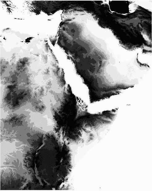
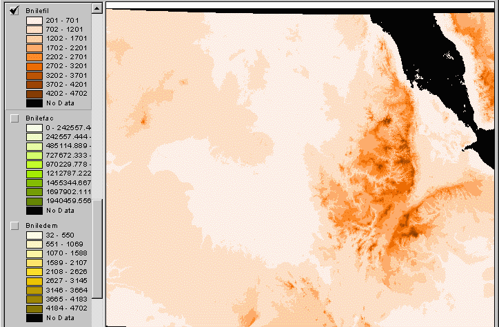
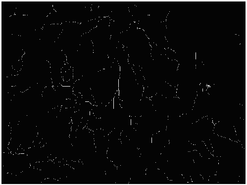
The DEM contains artificial sinks or pits which
are created when the DEM is constructed. On less such pits are filled-in, any water
reaching such cells will disappear into the pits. During the delineation of the Blue Nile,
the effects of such pits became rather apparent. The sinks were initially filled up to a
threshold of 100 meters.
Grid: fill bnileprj bnilefil SINK 100
#
As can be seen from the figure above, this
threshold was too low for the mountainous region in the Ethiopian highlands. It resulted
in portions of the Blue Nile being left out of the delineation. The pits were filled again
with a threshold of 800 meters.
Grid: fill bnileprj bnilefil SINK 800
#
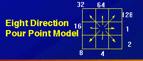
All the water falling on any given cell on the land surface is assumed to flow to the neighbouring cell of steepest decent. Since a cell as 8 neighbouring cells, it is assigned a value depending on which of the eight compass directions it drains in. The figure below gives the values for each of the compass directions.
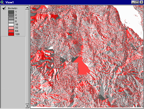
Grid: bnilefdr = flowdirection ( bnilefil )
Creates a flow direction grid called bnilefdr.
The flow accumulation grid is a count of the number of upstream cells which drain to a given cell. It can be converted to upstream drainage area by multiplying by the area of each cell. The flow accumulation grid is an important parameter to compute because it is a required input for a number of other delineation and analytical functions.
Grid: bnilefac = flowaccumulation (
bnilefdr )
Delineating Streams and Watersheds
The next step is to delineate the stream network. A delineation threshold must defined. This threshold defines how many cells must drain through a cell before it can be defined as a stream. Lets define a stream cell as one which has a drainage area of at least 1000 km2 and a river cell as one with a drainage area of 10000 km2. Each cell has an area of 1 km2 hence if we must define grids with values of at least 1000 and 10000 cells in the flow accumulation grid, respectively.
Grid: bns1000 = con ( bnilefac >
1000 , 1 )
Grid: bns10000 = con ( bnilefac > 10000 , 1 )
Now, the cells which have been defined as being on the stream network must be joined together to define a continuous direction of flow.
Grid: lnk1000 = streamlink ( bns1000
, bnilefdr )
Grid: lnk10000 = streamlink ( bns10000 , bnilefdr )
In addition to defining the stream network at
1000 and 10000 cell thresholds, we must also define watershed across the basin. The way to
do this is to identify cells with the highest number of upstream cells along each stream
in the network.
Grid: bnstmax = zonalmax ( lnk10000 ,
bnilefac )
When these cells are identified, they are isolated as the outlet cells for arcs in the stream network.
Grid: bnstout = con ( bnstmax ==
bnilefac , lnk10000 )
Watersheds are defined from the flow direction grid as the cells draining through that outlet.
Grid: bnwshed = watershed ( bnilefdr
, bnstout )
Grid: quit
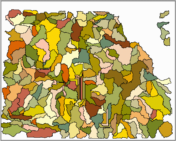
The watershed grid can now be converted to a polygon coverage.
Arc: gridpoly bnwshed bnbasin
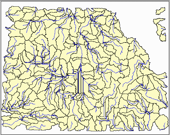
Similarly, a line coverage of the stream network can be generated at 1000km2 threshold
Arc: gridline lnk1000 bnstream
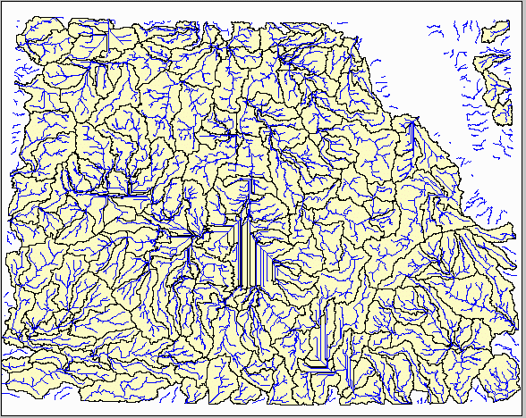
and at 10000km2 threshold
Arc: gridline lnk10000 bnriver
Watersheds and streams corresponding to individual basins can now be selected and placed into a separate coverage. These coverages can then be used for hydrologic analysis or visualization as required.
The delineation task is thus complete!
Go Back to
Center for Research in Water
Resources
Department Of Civil Engineering
The University of Texas at Austin